What to do, what to do...

Cheat

To cheap to buy a real map

Summit number 1 of the day

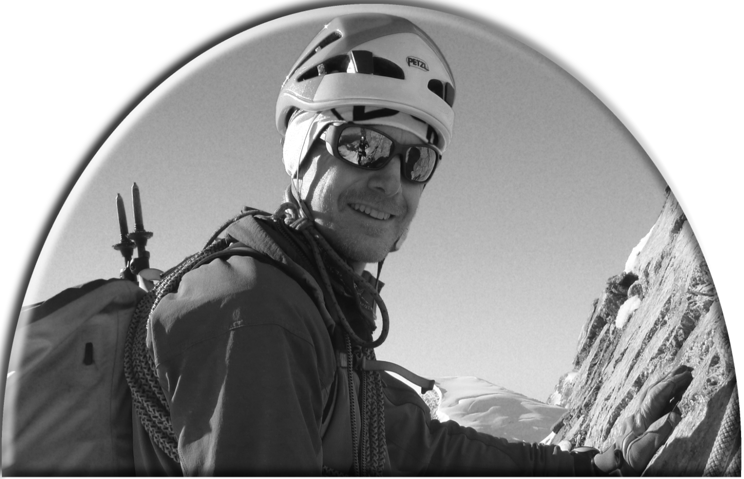
Mr P. Proud summiteer

Slight pointy bit in centre of picture. That’s our summit... Maybe.

The common Dandelion. Alpine style

One of them butterfly things

A drop of water caught on a leaf. Leafius dampus

Near the summit Mr P encounters the prettiest Mountain Elf ever. Anywhere.

A pretty bit of ground near the summit

Do I smell coffee? There it is!

Guess where?

The prettiest mountain elf ever, part 2

Mr P after Mrs P discovered his ‘little ruse’

Is that you Bilbo?

Gandalf in Imst
...as Pooh Bear once said. Friday August 30th and it's our last day in the mountains. Do we climb or do we go for a walk? Decisions, decisions.Much as we would like to do both we eventually decide on a hike. And, since time is limited we are going to cheat.We take the chairlift up from Hoch-Imst at 1,000m to 2,050m. We only have a freebie map. It's one of those horrible 3D affairs designed for people who can't read maps. This kind of map is infuriating.I have this theory that we can walk from the top of the chairlift at 2,050m, over the Hinteres Alpjoch (2,425m), down to the Mutterkopfhutte (1,934m) and back up to the chair lift. However, the HinteresAlpjoch is not marked on the map. Maybe it doesn't exist. Maybe it is the one have indicated. Maybe we should've bought a map! Maybe, maybe, maybe... However, it's a stunningly beautiful day, we are wearing walking boots and have made sandwiches. Only one way to find out...We quickly find a summit of sorts......and stop to pose with the ubiquitous summit cross.From where we can see our possible route.Time for a few flower pictures I think...In the UK such a walk would be rammed but, there's just us. This is because we have passed the magic, 20 minutes from the chairlift zone. Few users of such mechanical uplifts will go beyond this point without the imminent promise of a cup of tea or beer.We found the top of the Hinteres Alpjoch (2,425m). Disappointingly there was no cross by which to pose. Just a small yellow, plastic sign so, I took a picture of the ground instead...Anyway, lets go down to the Mutterkopfhutte. Where is it?The sign says 1.5 hours but we are 'ard and have gravity on our side. So, 45 minutes later...I was going to suggest a coffee but, strangely, the word 'beer' came out instead. Go figure!Under the influence ofein kleines Bier, I decide to try a ruse on Mrs P. I tell her that I am taking a picture of the reflection in her sunglasses when really I am just after a close up. She'll never know.She returned the favour...We finished it all off with a short but stiff (and rather Tolkienesque) walk back to the chairlift.The above picture is a vain attempted zoom in on the lone walker on the path. I hope he's insured, I'm sure his wife was right behind him about 30 seconds ago!A splendid last day in the mountains.Back at the campsite......Gandalf is patiently waiting.Tune in tomorrow for the tale of our, oh so hot, journey North.